Hiking Bukit Melati in Nilai

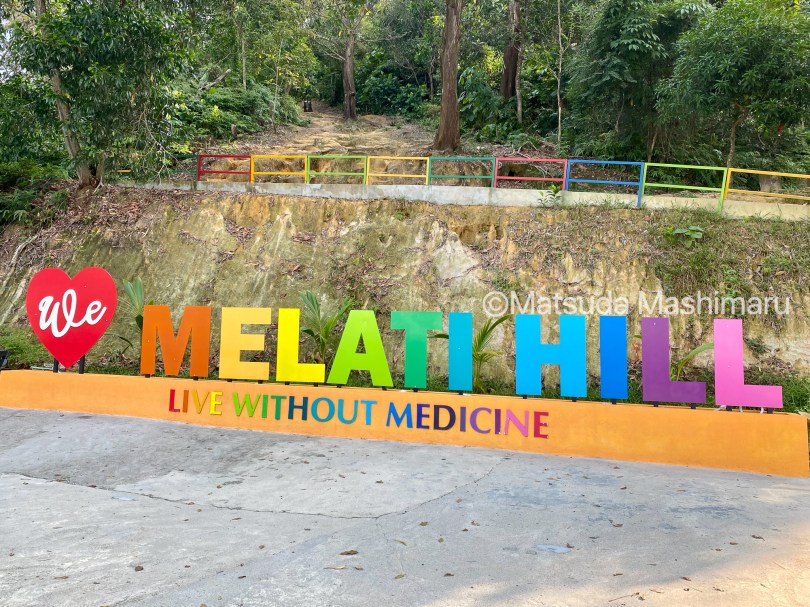
Yep … out of curiosity, I did a half-day hike to Bukit Melati, Nilai, Negeri Sembilan. The place is in the middle of a residential area at Bandar Baru Nilai, an old rubber and palm tree plantation converted into a recreation area.

  • Location: Bukit Melati / Melati Hill, Nilai
  • How to go: Waze for Melati Hill trailhead
  • Attraction: A half-day friendly-hike trail
  • Difficulty: Easy hike
  • Distance out and back: 3.6km full
  • Estimated time spent: 1 hour 30 minutes hike full circle
  • Tips: This place is very crowded during weekends/ public holidays. The best time to enjoy this place is during weekdays.
  • Leech level: I saw one leech while hiking 😳
  • Entrance Fee: None

Read More »

Why do people hike

I am not a mountain trekker.

Yes, I did a ‘day hike’ around Malaysia but I never try mountain trekking. The thought of having to endure pains and aches along the journey to the peak scares me. Why do I want to do that to my beloved self, my inner self voice talked me out each time.

Read More »

Mardi Himal trek

I decided to step out of my comfort zone and try something different.

When a good friend of mine suggested a new hiking trip to Mardi Himal, Nepal, I was skeptical. My body is not fit enough for long days of mountain trekking. My excuse is consistently the same, it’s not my kinda game. He shared with me a few beautiful photos of the Mardi Himal landscape, I googled more information about the place and later said yes to the trip.

Read More »

Hiking Denai Tiga Puteri

If you are looking for a good hiking spot around Klang Valley then you should try this trail.

A community-managed low-land forest area and a well-maintained hiking spot within the city area, Kota Damansara Community Trail is my choice for my speed hiking training during weekdays. The attraction of this easy 3.3 km trail from the entrance to the Tiga Puteri Peak, is a lookout spot overviewing north and southbound traffic thundering along the NKVE with a glimpse view of Kota Damansara township in the distance.

Read More »

Hiking Rawang Bypass

500 meters rambling from Taman Rawang Perdana to the trailhead, pass through a drainage tunnel underneath the Rawang Bypass highway then hike up on a steep wall retainer next to the busy highway on top of Bukit Matt (200m) for a gorgeous view of the highest viaduct highway in Malaysia. Going down is a challenge too. You either choose to hike down from the same route you came from or you could hike down on the other side of the hill and then cross over to the other side of the road through a path under the highway.

Read More »